The singing and the sea

Bute with shiny landscape tidiedWhen you put your boat in at Cowan Creek, you know you’re paddling in the sea.  Yes, there are rocky slopes on every side, and eucalypts and banksias lean over the shoreline.  The rows of hot pink bells of epacris longifolia dangle amazingly close to the waves.

But look over the side of your boat, especially in this big dry, and your gaze falls metres deep into into the crystal clear green water.  It might be called a “creek” but there’s no murky river water here.  Further downstream, where Cowan Creek meets the Hawkesbury proper at Broken Bay, the Pacific meets the horizon and you really know you are in the ocean.

Fishing boat and west head little boy

Fishermen off Flint and Steel Point

Cormorant with fish

Cormorant off Juno Point having a snack

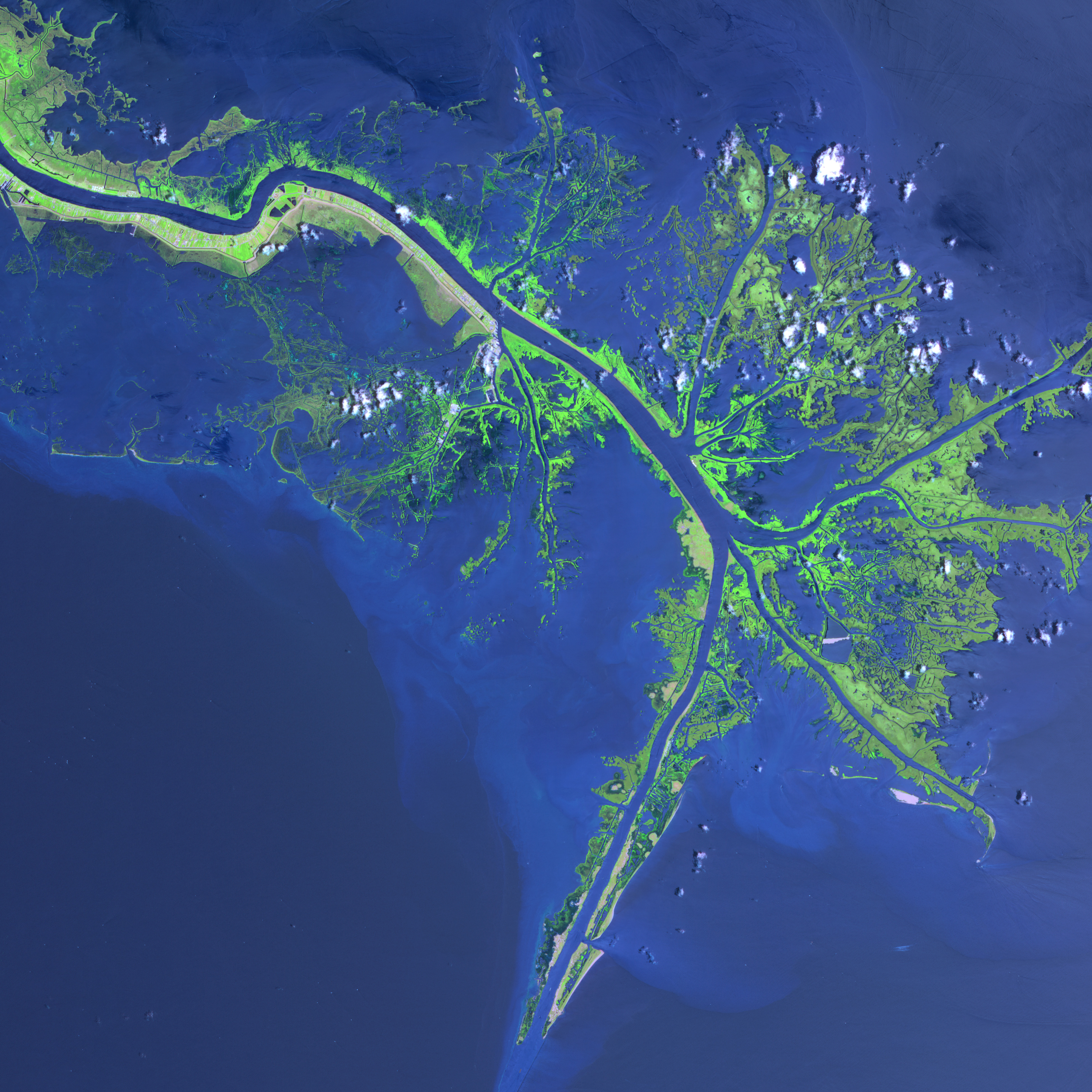
But far above the official mouth of the river – the limit of “flat water sailing” drawn between Juno Head and Flint and Steel Bay – the water is briny.  The tide rolls up the Hawkesbury as far as the Grose River Valley, 138 kilometres from the sea, taking a wedge of salty water upstream.  If Broken Bay, where these pictures were taken, is essentially a marine environment, Cowan Creek is not too much different.

Pixellated yachts

Yachts off Cottage Point

Because of course, the Hawkesbury is a drowned river valley.   The river channel that once wound its way twenty five kilometres to the east, across the continent shelf, has long ago disappeared two hundred metres or more beneath the ocean.  The late Quaternary Marine Transgression that drowned the Hawkesbury started 18,000 years ago and went on for 10,000 years, with the water level peaking just a metre or two above current sea levels.

Paul Boon, in his fascinating history of the Hawkesbury, reports that during that time, sea level rose at perhaps 8-10 metres every millennium, at some times as 40 metres in a thousand years (Boon, 2017, Chapter 3). It‘s hard to imagine what that must have been like for the first people here, the Guringai and Dharug people, moving again and again ahead of the rising tide, away from the coastal flat lands to the hills of the Hornsby plateau.

Side illuminated trees for crop

On the way to Stingray Bay

Even more mindboggling to think, as Boon quietly points out, that over the last few decades sea level has been creeping up by around three millimetres a year. If the CSIRO scientists are right, and I for one don’t doubt they are, sea levels are changing as worryingly fast, if not as fast as the speediest rises in the Flandrian Transgression. On the bright side if I live long enough, there’ll be far more of the upper reaches of Cowan Creek to explore, in an admittedly sweaty and decrepit manner, in my kayak

Pink cloud and cowan creek

Sunrise sky near Cotton Tree Bay

Last weekend’s paddle reminded me of what a special place the Hawkesbury is, a drowned river valley where, after rain, waterfalls tumble off the sandstone straight into the sea.  I was coming back from a jaunt to Smith’s Creek when, heading into a bay to avoid a plague of water skiiers, I heard a lyrebird going for broke.

According to Birdlife Australia, superb lyrebirds are inhabitants of moist forests. I’m sure the one I heard scratching around in the undergrowth by the shore, would soon be heading back to the gullies and the treetops.  But in its distant melange of calls – of satin bowerbirds, kookaburras, currawongs, red wattlebirds and other things I just can’t recognise – was a sound I’d never heard a lyrebird make before.  I’m sure I heard an impression of that paradigmatic bird of the beach – the silver gull.

And that’s the soundtrack of the Hawkesbury estuary, right there,


What are your bird call spotting skills like, dear reader?  Can you recognise any other shore birds in this estuarine lyrebird’s song?  If you can spot any extra calls, please let me know!

Other stories from Cowan Creek and thereabouts

A glimpse of a peregrine falcon hunting: death and good fortune in Cowan Creek

Old hands: how Smith’s Creek was nearly Canberra

Stingray Bay – lost and found

The Hawkesbury in winter: the shortest days and how to use them

Broken Bay at low ebb: the troubled history of Hawkesbury oysters

Around the point 2

A winter morning in Cowan Creek

Delta bravo!

Kylies from the headland 2011

Kylie’s Beach in Crowdy Bay National Park

It’s lucky that travelling in reverse is just as easy as going forwards in Egg, my decrepit wooden kayak (currently held together with duct tape), because lately my paddles seem to be taking me back in time.  Back to old haunts and old holiday snaps, but also really really far back into the geological past.

When I took this photo of beautiful Kylie’s Beach in Crowdy Bay National Park in 2011, for instance, I wasn’t thinking “My, what a fine example of a barrier dune system in a wave dominated estuary!”

And  this snap from North Brother Mountain, taken on the same trip five years ago, demonstrates that I wasn’t paying enough attention to geomorphology at the time.  It’s not a bad shot of the 100,000 year old Pleistocene sand barriers that protect Watson Taylor Lake from the crashing waves of the Pacific.  But, in retrospect, I should have given the picturesque tree on the right the flick, and made sure I squeezed in a view of the mouth of the Camden Haven River.

Because, for the New South Wales anyway, this is a pretty special place.  As you can see in the pic below by a more geologically literate photographer, enfolded in the lake is a classic river delta – a rare sight in this part of the world.  It’s a mini-Mississippi, sloughing off its sediment as it flows into stiller waters, leaving muddy banks along the way and a cluster of little islands at river’s end.

watsontaylorlake

Watson Taylor Lake.  Bias, Gene. watsontaylorlake.jpg Pics4learning July 2004. 9 May 2016 <http://pics.tech4learning.com>.

Sad to say, I didn’t notice all this deposition and composition as I paddled down Camden Haven Inlet at dawn, skimming over the seagrass and the sand. Even when I got stuck in the mud – sorry, fluvial sediment – right in the middle of the lake. At high tide.  Next to a bunch of knee deep swans.  Sometimes I reckon I’m not the sharpest knife in the knifeblock.

Swans horizontal

Black swans smirking while I try to get afloat after running aground in the middle of the lake

It was only back at camp at Kylie’s, over a first reviving brew-up, when I stumbled on Rod’s Northern Rivers Geology blog with its intriguing story of the missing coastal deltas of New South Wales that I figured out what I’d seen.

Thinking back, I realised I’d been somewhere very similar just a few weeks ago, in another one of the New South Wales’ magical coastal lagoons.  Where Dora Creek – home of freakish panda-snakes – empties into Lake Macquarie, the very same levees march, both sides of the river, far out into the open water.

Dora Creek doesn’t have mangrove topped islands at its mouth, like the Camden Haven. Perhaps their beginnings were washed away by the waves that scoot across five kilometres of open water to scare the hell out of unwary kayakers.  In the same way storms, waves and the East Australian Current sluice river sand and sediment out into the Pacific or up the coast, leaving barrier beaches in place of river deltas all along the Eastern seaboard.

Island in river mouth small.jpg

Island in the delta

But in the sheltered estuary of Watson Taylor Lake I got to enjoy all the rare pleasures of a river delta.  Mosquitoes, for instance.  More than I’ve encountered anywhere, even my backyard, locally famous for its blood buffet and chubby and contented microbats.  With the mozzies come the mozzie eaters.

I stopped to take pictures of the wood swallows, but in fact, this little beach, at the very end of the Camden Haven’s levees, had almost as many birds as it had bugs. Honey-eaters in an array of colours: brown, striped and yellow-faced. Noisy friarbirds, mobs of them, bursting from the casuarinas to wheel and chatter. Wagtails and fantails.  Crested terns chilling out away from the surf.  A drongo (I’m not being insulting – it’s a gorgeous bird).  Not to mention a special treat – the rarely sighted fungus-faced thornbill.

And, as I wended my way through the maze of islands with the help of the handy map in my Paddlers Guide to NSW, an unflappable young sea eagle, rising majestically above the cloud of biters.   It takes a genuine love of raptors to continue taking snaps while half a dozen mosquitos are sucking on your eyelids.

But as RB just reminded me, if Australia’s eastern coast is wanting for river deltas now, it’s not always been so.   It was an enormous braided river delta, like the Amazon or the Ganges that laid down the golden Hawkesbury sandstone, a couple of hundred metres thick, right across the Sydney Basin, 230 million years ago.

Perhaps this is an approach to marketing I can put to the NSW Tourist Board. “Volcanos!  Dangerous megafauna! Epic braided river deltas! Go back far enough in time, and New South Wales has it all!!”

North brother reflection

Reflections of North Brother Mountain on my way back to the put in at Camden Inlet

More adventures on New South Wales’ coastal lagoons

Geomorphology and dawn reflections on a midwinter lagoon at Myall and Narrabeen Lakes

A paddle across scary Lake Macquarie to see the snake-pandas of Dora Creek

Encounters with eagles on Budgewoi Lake

Moonlit bay lighter real

Moonlit night on Kylie’s Beach

Alhambra on the Hawkesbury

The last few times I passed by Bujwa Bay, on my way downriver from Berowra Waters, it was shrouded in mist.

But last Sunday, in the golden light of late afternoon, there was a revelation.

I’m familiar with the Hawkesbury’s sculpture parks and sandstone art galleries.  But the fact that Berowra Creek had well preserved fragments of an ancient Moorish fortress – well, that was news to me.

When I went home and told RB I’d seen something very like the famous stucco inscriptions of the Alhambra on a estuarine cliffside at the end of Berowra Waters Road, his comment was “You’re barking!”.  And he’s probably right.

After all, the Alhambra is an artistic jewel, a masterwork of European Islam, preserved over the centuries after the Moors themselves were driven first into the mountains and then out of Spain altogether.  Its delicate carved plasterwork miraculously survived Christian conquerors, dodgy architectural restorers, squatters and tourists.  And the sandstone of Bujwa Bay is just, you know, rock.

But I’ve been reading about “thing power” and it’s given me a whole new angle on inanimate objects.  “Thing Power!” – sounds like a killer bathroom cleaner that will sort out all the disturbing life-forms, named and unnameable, in your shower cubicle.

But according to Jane Bennett, its “a creative not-quite-human force capable of producing the new [that] buzzes within the history of the term ‘nature’ ” (2010, 118).  Electrons, microbes, minerals, waste, all busily making and shaping things, inside, around, through, against and despite humans and their fancy-pants plans.  She reckons things and people rub along or against each other in a pattern that’s “not random or unstructured, but conforms to the strange logic of vortices, spirals and eddies” (2010, 118).

Kooky as it sounds, this is not a bad description of how the Bujwa Bay Alhambra came into the world, according to a paper coauthored, in a way that pleases my penchant for magical thinking, by a geologist from Granada, home of the famous palace.

Honeycomb weathering like this happens in all sorts of porous rocks, around the world – from Antarctica to Jordan – and maybe even on the surface of Mars. It might seem like  hollows would form in weaknesses in the rock, but it’s not necessarily so. Blistering heat, frost, chemical weathering and rain are all in the frame – with maybe a little help from the odd patch of algae or lichen. But mostly it’s about salt and wind.

Salty water – in this case from seaspray – seeps into the rock and crystallises, making tiny fractures. If there’s plenty of water, salt crystals forms on the outside surface to form efflorescence, a mineral flowers blooming on a cliffside or a cellar wall or a garden fence.  But the real damage is done deep in the rock.

According to Rodriguez and friends, once a depression is formed in the rockface, wind eddies and swirls inside the concave parts of the stone.  Faster breezes mean more evaporation and a super-saturated salt solution, meaning more salt crystals and more fretted stone. Eventually the rockface becomes lacework, without any intervention by a rock lacemaker.

Alhambra rocks 1 crop long

The other name for honeycombed rock is alveoli.  It’s stone with lungs.  Made of mineral flowers.  Not alive (or mostly not alive – sorry algae) but doing complicated and beautiful things.

Not immortal, invisible, unfathomable.  In fact, as fathomable as the waters of Bujwa Bay at low tide, that is, knee deep to a heron.  Just exceedingly hard to grasp.

And that’s not just me banging my head against a corroding brick wall of “Salt weathering: a selective review” – the geologists are still bickering over exactly how it works. In Bennett’s (possibly slightly loopy) words, it’s vital matter, “hard to discern… and, once discerned, hard to keep focused on.  It is too close and too fugitive, as much wind as thing” (119).  Or perhaps, in this instance, both wind and thing.

tiny crab and shadow.jpg

A crab wondering what I’m on about, on a beach near Bujwa Bay

References

Jane Bennett 2010 Vibrant Matter, Duke University Press

Eric Doehne (2002) “Salt Weathering: a selective review” from Natural Stone, Weathering Phenomena, Conservation Strategies and Case Studies. Vol 205, 51-64, Geological Society Special Publication

Carlos Rodriguez-Navarro, Eric Doehne,Eduardo Sebastian (1999) Origins of honeycomb weathering: The role of salts and wind, GSA Bulletin; August 1999; v. 111, no. 8; p. 1250–1255

Huinink, H. Pel, L, Kopinga, K. 2004 “Simulating the growth of tafoni” Earth Surface Processes and Landforms 29 1225-33

Midwinter lagoon

It’s past the shortest day of the year, but, in spite of her scrapes and dings, Egg the elderly wooden kayak doesn’t seem to be ready for drydock yet.  Perhaps it’s that last unseasonable whirl of autumnal warmth, caught alongside the coast in the East Australian Current, that’s keeping the sea a balmy 20 degrees.  Or perhaps it’s just the lure of still, winter water all around.

Since Egg was first laid in our driveway a year ago, I’ve been seeing Sydney differently.   Those long roundabout routes from A to B via M and Q and P, punctuated somewhere along the way by a bridge or two, suddenly make sense.  The city of roads and buildings retreats and, I feel, just out of sight on every side, the presence of water.
.

This is our backyard, encircled by the salty embrace of the Hawkesbury estuary.  But it doesn’t end here, with the secretive topography of flooded river valleys. All the way up (and down) the New South Wales coast, the shoreline is flanked by coastal lagoons. I’m not complaining, even the tiniest little bit, about all these sheltered waters.  But I’ve started to wonder what geographic accident has given a timid canoeist so much to feel grateful for.

Along with marshes and flats, coastal lagoons make up maybe 10% of the world’s seaboards, and in NSW lots of us live by them, many more than by the ocean itself. Lagoons (or wave-dominated estuaries – there are ongoing hissy-fits around these definitions) appear where low-lying plains, rather than dramatic cliffs, meet a shallow gently sloping seabed.  Usually, they are found on shores shaped mainly by waves rather than big tides, with underlying rock that crumbles nicely into beach sand not finer, silty sediment.

The more sand the better – perhaps our generous continental shelf harbours this bounty from a time when the Sydney Basin was a enormous braided river delta, like the Ganges today.  But you don’t want too much rain – lagoons are usually fed by an underwhelming little creek or even just groundwater – that doesn’t (or doesn’t often) burst through the land between waterway and ocean.

To make a lagoon*, you need a barrier to the open sea.  In the nineteenth and first part of the twentieth century, coastal geomorphologists duked it out over just how these barriers were born.  Did breaking waves make for ever-rising off-shore sand bars?  Did encroaching seas submerge coastal dunes? And then there’s the third, attractively named “spit accretion theory” (Davis and Fitzgerald, 2004).  Not, as it might sound, a creation myth where bunyips drool into puddles between the dunes; just sand clinging to rocky headlands as it is carried along the coast by the (delightfully piratical) longshore drift.

It turns out that everyone was right, at least some of the time.  Which is nice.  It’s hard to keep the heat in a scientific controversy when lots of the evidence, hidden beneath the surface of the sea in the first place, has been washed away or covered over during the last few millenia by terrestrial silt or aeolian sand.  Who could be angry with such mellifluous and frankly otherworldly-sounding geomorphologies in play?

Most lagoons have only been around for a little while, geologically speaking, formed after sea levels began to rise as glaciers melted 18,000 years ago or thereabouts. Many, like Narrabeen Lake, which we whizzed round on our bikes in the company of half the population of the North Beaches a few weeks ago, are even younger, not seven thousand years old. A blink of the eye for people who were here 50,000 years before.

Strangely, lagoons move.  Today’s surfers walk across the relics of yesterday’s drowned lakes.  Barrier beaches migrated landward, emerging from the ocean just as “marine transgressions” (that’s advancing oceans, not the naughtiness of waves) slowed.  Shaped in stable times, coastal lakes still don’t hang around for long.  This shouldn’t surprise me – I know that, despite appearances, beaches are really rivers of sand.
.
If the tides were higher, if the rivers was faster or siltier, if Australia wasn’t so seismically serene, the lagoons would fill up and dry out or be washed away, and the cormorants would have to hunt elsewhere.  In fact, for all our dredging and draining, it’s happening right now.  Like life itself, coastal lagoons are a transitory phenomenon, a passing pleasure.
.
But sometimes, under the fresh sand and brackish water there are older and odder things. The beautiful Myall Lakes, where we not long ago spent a glorious weekend, lie in the bed of an ancient river, separated from the sea not just by dunes that arrived ten minutes ago (okay, 2,000 years ago) but also by the Inner Barrier, deposited before the last glacial maximum and thirty times older.
.
And then there’s the gyttja, something so very special it’s found nowhere else in Australia, and helps qualify Myall Lakes as a unique protected wetland.  What is it?  Well, rotting pondweed.  No, I’m underselling it: it’s up to 70cm of  “a highly mobile and organic mud that has a gelatinous appearance”, a “flocculent green–brown material” (Drew et al 2008), “an uncompacted, anoxic and sulphurous ‘ooze'” made from “the decomposition of charophytes, macrophytes, cyanobacteria and algae”.  Strangely, not so much about the ooze in the National Parks brochures.  But it’s an ooze that’s been there for, perhaps, a thousand years.

I’ve been thinking about lies beneath the surface of the water and the windblown sand.   But paddling through the Broadwater two weeks back, in a startling moment I found myself not gliding above the mysteries of quiet waterways, but surrounded, right amongst it.  A huge flock, a murmuration almost, of little black cormorants, perhaps returning from a fishing trip, passed above and on one side and on the other without a single cry but with a sound I’ve never heard before: the white noise of hundreds and hundreds of moving wings.

The sound of the midwinter lagoon, all around me.

* Be warned: there’s a chance my account of the origins of coastal lagoons is completely wrong.  After all, the New South Wales coast “has provoked many questions and various degrees of controversy” (Thom, 2010, 1238).  And perhaps it’s “premature to attempt a comprehensive analysis of coastal lagoon evolution and dynamics when so many lagoons have been so little studied” (Bird, 1994, 13). In case you want to check my workings:
References
  • Bird, Erik (1994) “Physically setting and geomorphology of Coastal lagoons”  in Kjerfve, B. (ed) Coastal Lagoon Processes, Elsevier
  • Davis, R. and Fitzgerald, D. (2004) Beaches and Coasts, Blackwell Science
  • Drew, Simon Iona Flett, Joanne Wilson,Henk Heijnis, C. Gregory Skilbeck (2008) “The trophic history Myall Lakes, NSW, Australia”  Hydrobiologia 608
  • Eyre, Bradley and Damien Maher “Structure and Function of warm temperate east Australian lagoons: implications for natural and anthropogenic changes” Coastal Lagoons: Critical Habitats of Environmental Change, dited by Michael J. Kennish, Hans W. Paerl
  •  Martin, Louis and Jose Maria Landim Dominguez (1994) “Geological history of coastal lagoons” Kjerfve, B. (ed) Coastal Lagoon Processes, Elsevier
  • Masselink, Gerhard and Hughes, Michael (2003) Introduction to Coastal processes and geomorphology, New York, Oxford University Press
  • Thom, Bruce, Hesp, Patrick, Bryant, Edward (1994) “Last glacial ‘coastal’ dunes in Eastern Australia and implications for landscape stability during the Last Glacial Maximum” Palaeogeography, Palaeoclimatology, Palaeoecology 111 (3-4)
  • Thom, Bruce (2010) “New South Wales” Eric Bird (ed) Encyclopaedia of the World’s Coastal Landforms, Springer

In other sandstone country

Wiradjuri country that is, or Dabee country to be precise: Ganguddy, on the Cudgegong River, that flows west off the Great Dividing Range, not into the Pacific but into the Murray-Darling.  Not far from Berowra as the Australian Raven flies – straight across the Wollemi National Park – but a fair trek in the excessively laden ancient vehicle.

Still sandstone though – the older, niftier sandstone of the Narrabeen Group, as it resurfaces at the very edge of the Sydney Basin, with the even older coal measures being mined perilously close byLayers of ironstone make for fabulous rock formations (if slightly less way out than the famous pagodas of the nearby Gardens of Stone National Park).  And of course exceedingly soggy tent groundsheets when big rain sluices off the rocks faster than even sandy soil can soak it up.

Same old sandstone geology, plenty of still water, just like the Hawkesbury estuary down our way, but the critters are different.  The feathered food thief at Ganguddy isn’t a brush turkey, it’s the purple swamp hen.

The “house bird” is a cheeky superb blue wren, not a wattlebird.  Rainbow lorikeets – not a one.  And none of those aggressive urban generalists, the noisy minors or the magpies, either.  Instead crimson rosellas – a rarity in the northern suburbs of Sydney – lurk in implausible locations like the queue for the drop dunny for instance, or the reeds by the river bank.

The ubiquitous but largely invisible bird here isn’t a koel or a channel billed cuckoo but the aptly named clamorous reed warbler.  I was at times tempted to nip to the Rylstone Guns and Ammo for a small flame thrower so I could finally get that photograph, but then I reflected that a perfectly focussed snap of a tiny blackened corpse clinging in its rictus to a reed probably wasn’t in the spirit of the thing.

A fabulous place.  It’s tempting, what with proximity to World Heritage listed Wollemi National Park and all, to think of it as a wilderness.  But no.  Its gorgeous waterways are the product of a 1920s dam built to to supply a cement works, its teeming fish the introduced gambusia affinis – the “plague minnow” – that outcompetes the locals, though it does seems to keep the mosquito population down.  As a camper it’s hard to argue with that, although we didn’t see a single bat, micro, macro or meso, during our five day stay.

There’s something to be said for human intervention, as Tim Low says.  In the absence of railway station eves or even a well put together shed, the welcome swallows in desperation had to resort to nesting on the natural stone outcrops.  But the local water dragons and turtles seemed to relish the fetid smelling pond downstream from the dam.

A tranquil place with a violent past.  A “natural” place shaped for a very long time by people in ways that you see and ways that you (or at least I) don’t know enough to notice.  A familiar story, on sandstone and otherwise.

Happy International Year of Soils!

I’m not kidding.  The UN has declared 2015 the International Year of Soils.  And not before time.  Everyone should be preoccupied with dirt.  I know I am.  What is going in down there, under the ground? Are my veggies growing in podzol or mycelium? Hang on, that’s soil profiles in Minecraft, not in Berowra.

The CSIRO’s recently released Soil and Landscape Grid with its 3 dimensional digital soil attribute maps could resolve most Australian gardeners’ soil questions. In case you were wondering how these maps were developed, let me put you out of your misery:

“The spatial modeling was performed using decision trees with piecewise linear models and kriging of residuals. Fifty environmental covariates that represent climate, biota, terrain, and soil and parent material were used in the modeling. Uncertainty was derived using a bootstrap (Monte Carlo-type) approach to derive for each pixel a probability density function (pdf), from which we derived 90% confidence limits”

More kriging of residuals, I say!

Gags aside, this free online resource shows why Australia needs publicly funded science and why sacking researchers in the CSIRO to bankroll Gina Rinehart’s tax breaks is a major error (if you need more persuading, CSIRO scientists also invented WiFi, Aerogard, the permanent pleat, and the word petrichor, which describes the lovely smell of damp earth after rain).

After reading about the rocks in our neck of the woods, however, I’m not sure we are best placed to fully exploit the sophisticated visualising technologies of the Soil and Landscape Grid.  The geology around here is pretty danged boring. Other than the odd lens of shale, mostly on the ridge-tops (that is, under roads and houses) it’s Hawkesbury sandstone all the way down, 40 million years and 270 metres of it.  Or at least, all the way down to Berowra Creek where there’s an outcrop of more fertile Narrabeen Group of shales, sandstone and clays here and there.

Of course, we’re not alone in our preposterously deep beds of sandstone.  They’re on display in the Blue Mountains too, though with a few more layers clay and basalt intrusions to break up the tedium.

The humungous quantities of sandstone across a swathe of the Sydney Basin makes my sentimentality about the disappearing rock faces along the new railway cuttings of the Northern Line even more absurd.  After reading about the good exposures of Ashfield Shale between Hornsbury and Beecroft,  I’ve become a tiny bit obsessed with capturing the freshly exposed slices of Sydney Basin geology as they are revealed by the diggers and before they’re covered with nasty grey concrete.  Wordsworth was mortified by the ugliness of railway cuttings slashing their way through the nineteenth century British countryside.  Here am I mourning for disappearing railway cuttings, a slice of geological time revealed and then lost again.

Perhaps I should stop grieving the lost glories of the Pennant Hills trackwork and spend more time worrying about what my garden might be doing to the “quartz rich, nutrient poor” soils of Berowra.

My snake beans are kinda sallow – I reckon they need a side serve of well-rotted chicken manure.  But even as I contemplate emptying the compost tumbler, I can’t help but fret about where my vegetable garden sits, perched above the national park with its “rich and distinctive assemblage of species that thrive on poor soils” , “60-80 different plant species growing together on an area half the size of an average house block” (Benson, Howell, McDougall, 1996, 24-5).  Benson and Howell in their fascinating Taken for Granted: the bushland of Sydney and its suburbs (Kangaroo Press/Royal Botanic Gardens, 1990) mourn:

 “much of Hornsby’s rugged sandstone terrain remained undisturbed until after World War III when the increasing availability of the car and improved building technology made steeper, more remote sites available for housing.  As a result, bushland on ridge-tops and upper slopes has been totally destroyed, the bush remaining only where it is virtually impossible to built, and along steep gullies which have become drainage lines.  Virtually very catchment system includes some suburban development, stormwater run-off from which contains silt and nutrients.  These promote weed invasion of sandstone gullies… in newer areas such at Mt Colah and Berowra [the] invasion is beginning, and the consequences appear inevitable” (108)

And that’s us, in our mid-century twentieth century house, teetering on a steep slope in a fold of the hillside you might otherwise call a creek bed.  My painstakingly-made hot compost, my organic sugarcane mulch, the poo from my beloved chickens, all building nitrogen, carbon, phosphorus rich earth – garden alchemy.  I’m creating an anthroposol – a human made soil – and I’m not entirely sure that’s a good thing.

As a homage to the UN’s declaration, I’ve stared in a  incomprehending way at a schematic cross-section of Hawkesbury soils, I’ve thought long and hard about our B horizon (by staring even longer at this quite marvellous online introduction to soil classification – thanks again, CSIRO) and I’ve double-checked Minecraft’s definition of “podzolic” with the kids but I’m not sure how far it’s got me.

Maybe this is the chthonic thinking – thinking about the soil and the communities, plant and animal that grow from it – that my friend Kate urges us all to do in her fab blog about the Armidale Community Garden, but it’s not so much grounded me as taken me directly to Hades via the Field of Punishment.  This is a special special place of suffering for people who long to understand rocks and dirt but can never remember whether the Devonian comes before or after the Carboniferous, no matter how many times they read David Johnson’s splendid Geology of Australia.  And that’s without wrestling with the geopolitics of topsoil loss or the impact of international agribusiness on pesticide residues or the links between soil, country and indigenous chlthonic law

The only solution to this torment, I feel, is another variant of subterranean thinking: that sense of mindfulness I get sitting in a darkened vehicle with a swag of empty shopping bags, gazing tranquilly at the carefully preserved, sandstone rock exposures in the underground car park of Berowra Coles.

Happy International Year of Soils everyone!