I’m running out of map!
It’s not a real cartographic apocalypse – a Ken Loach-influenced Dr Who episode in which all the world’s maps are stolen away by some evil alien civilisation heavily invested in NavMan shares. But after a year with my canoe, there’s not much unexplored territory on this part of the Hawkesbury. I’ve nearly done with the alchemy of my Saturdays: transmuting ink on paper into trees and water and mist.

White bellied sea eagle flying through the mist

Milson’s Island, escarpments behind lit up by the dawn

Near Marramarra Creek

Misty trees in Muogamarra

Tinny in the morning mist off Bar Island

Looking up the Hawkesbury River
Maybe it’s my fading memories, but as I paddled just after dawn from Deerubbin to Kimmerikong Creek, I kept thinking of the west coast of Scotland. Something about morning fog: the sea eagles appearing and vanishing; mist spilling over the ridgelines and pouring down the slopes like an evanescent avalanche.
I remember my first view of Glen Coe through the bus window, RB naming each hill as we passed. What a gift, I thought, to know a place like this so very well.

Glen Orchy hills from Rannoch Moor

Buachaille Etive Mor in Glen Coe

Aonach Eagach

Peanmeanach from An Stac

Loch Lomond

Peanmeanach

The Cuillin on Skye from Arasaig
I was at a disadvantage this Saturday: I forgot my map, carefully folded into its extra large, double-sealed “Hercules” zip lock bag and left on the kitchen table. Google Earth is one of those things that prove we really do live in the future. And RB is always complaining about how rubbish Australian mapmakers are compared to the unsurpassable Ordinance Survey. Even so, I still think maps make us into gods.
With a map you know what’s going to happen next: what’s beyond the next hill or around the next corner. Geological maps and navigational charts are even better – you see into the depths of ocean or stare right through the surface of the earth. Short of being an X Man with laser eyes or clairvoyant powers, it just doesn’t get any better than that.
If you’re going to claim someone’s country or rewrite its history, of course, a map is a magnificent weapon.

Bar Island

Great Cormorant near Bar Island

The whistling kite of Bar Island
Of course, the untraversed parts of the map are the tricky ones, a little bit too far away from a put-in, further than the old easy jaunts. So it’s through known country to the unknown: past the Whirlpool of Death and Bar Island’s grumpy whistling kite, beyond the verdant urine-fertilised fields of warrigal greens at Back Beaches, though not quite as far as Ant Hill Point (saving that excitement for a really slow weekend). Just when you feel you are truly in the wilderness, with only cormorants for company, you turn a corner and there’s a line of houses that look like they’ve been helicoptered in from deepest suburbia. I half expected to hear a solar powered leaf blower or hedge trimmer.
Just across the other side of Berowra Creek, Muogamarra Nature Reserve is deliberately kept something of a secret. It’s only open to the public six weekends of the year, in early spring. There is a field station there, and in the water of Kimmerikong Bay scientists have been testing those Qx resistant oysters I regaled you about a couple of months back. The reserve was originally declared in the 1930s to protect the many rock carvings, hand stencils, scarred trees, middens and grinding grooves there: this is a landscape long and intimately known. However, I guess National Parks are trying to stop this particularly lovely part of Hawkesbury sandstone with its 14 mammal species (including tiger quolls!), 900 plant species and 140 varieties of birds from being “known” in a biblical sense; that is, not to put too fine a point on it, screwed.

Threatening sign

Grey spider flower

Boronias of some sort

Isopogon

Some sort of leptospermum

Red spider flower
I hear that Cowan, the town that sits on the edge of Muogamarra, had a crime-wave a while ago. Since no-one locks their cars, a street’s worth of gps’s disappeared in a single night. A sign was put up in the window the general store: if all the missing devices turned up outside the community hall there’d be no need to call the police. Everyone got their Tom Toms back. This story gives you a hint of how the people of Cowan might view the official regulations preserving the sanctity of Muogamarra. Since I was an incomer from Berowra, a good six kilometres away, however, I figured I was safer keeping my feet in my canoe as I wound my way through down Kimmerikong Creek, deep into the reserve.
The creek, looping from the cliffside on one side of the valley to the escarpment on the other, looks nothing like it does on the map, but exactly as it does from space, the shroud of mysterious grey mangroves slowly falling back as you paddle upriver, exposing the glint of the creek to a satellite’s view.

Mangroves at the base of Kimmerikong Bay

Grey mangroves again – or are they river mangroves

New muddy baby mangroves

Grey mangroves and the northern side of the Kimmerikong Creek

Bottom of the cliffside in Kimmerikong Creek

Grey mangroves at half tide
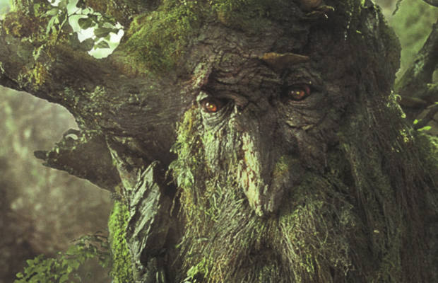
Google Earth may have imaged the mangroves of Kimmerikong Creek to its satisfaction but I know I haven’t captured it to mine. Somehow my wan photographs of these flooded forests fail to catch the sense of invisible ferment, mysteries hidden between the hoary tree trunks and their reflection, the hush that hints at unknown things slowly emerging. I imagine a wading Ent, striding and squelching towards me through the mire, hairy-legged with pneumatophores and flanked by an bevy of miniscule leaping fish, wearing a National Parks and Wildlife uniform and demanding payment of that $3,000 dollar fine.
No Ents this time, though, and no bird photos either. I heard, I think, maybe 138 species of bird as I ducked and crashed through the overhanging branches, and didn’t see even one. Perhaps I need to get up even earlier – 4 am? 3 am? – to capture the mangrove’s magic, as The Goat the Wrote does in his stunningly beautiful photos. The stalwarts of the Hawkesbury Canoe Classic can paddle all night, so why can’t I? 111 kilometres in a one day – with that kind of stamina the folds of the map would open up like a flower. Ant Hill Point here I come!
I’ll have to work on it. This time there was no bonk, but the pied cormorants of Milson’s Passage looked on pityingly as I swirled downriver through the tidal race, kermit-armed, back home to my plans and my maps.

Inquisitive look from a little pied cormorant

The way back to Milson’s Passage


